Signed in as:
filler@godaddy.com
Signed in as:
filler@godaddy.com
Our 2D mapping services are a powerful tool for displaying elevation changes, building layouts, job progressions, and more. These maps provide an accurate, up-to-date visual of your project, making it easier to track progress and communicate effectively with your team and stakeholders.
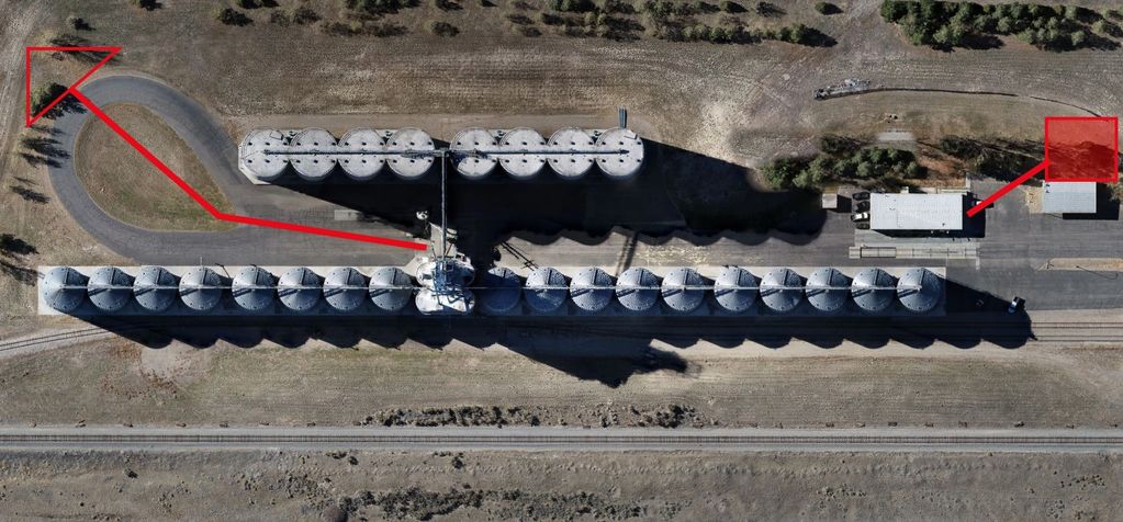
We can incorporate custom graphics into your maps to

Progress reports created from 2D maps provide a powerful way to visualize job progression over time, ensuring clear communication with everyone involved in your project. These reports make it easy to share detailed updates with clients, buyers, lenders, and employees, keeping all stakeholders informed and aligned.
In addition to tra
Our 2D maps provide a detailed visualization of elevation changes on a property, helping you identify and plan for potential challenges. This includes addressing drainage issues, determining foundation wall depth for frost protection, calculating foundation wall height, and estimating the amount of landscaping required to complete the project.
With accurate elevation data
Mapping services are essential in the real estate industry, providing precise and up-to-date maps with accurately added property lines. These maps ensure clarity and transparency, making it easier for buyers, sellers, and agents to make informed decisions. By offering reliable visuals and data, mapping services contribute to smoother and more s

We can create detailed maps of your factory, plant, or place of business and enhance them with custom graphics. These graphics can highlight essential features such as emergency exits, meeting points, medical aid stations, or any other areas your business needs represented. Our mapping services ensure your team, visitors, and emergency services have ac
Drone Perspective Services LLC
We use cookies to analyze website traffic and optimize your website experience. By accepting our use of cookies, your data will be aggregated with all other user data.